Castle of Monemvasia #207


- Purpose
- Excursion
- Type
- Castle
- Country
- Greece
- City
- Monemvasia
Share links
Description
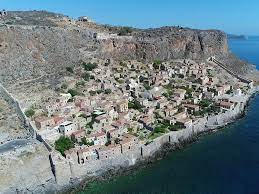
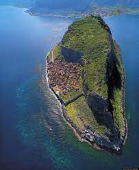
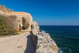
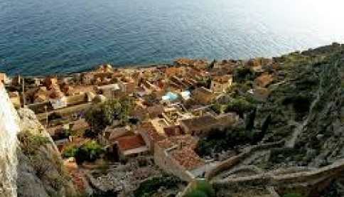
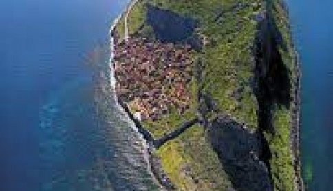
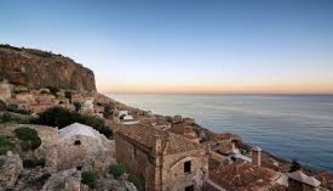
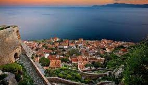
Monemvasia is built on a rock with the only access from land, a narrow strip of land from which it got its name. Its natural location had made it an ideal refuge during barbarian raids.
It was founded in the years of Emperor Mauritius in 583, when the inhabitants of the surrounding areas were looking for refuge from the raids of the Avars and Slavs.
The city seems to have been initially founded on the highest plateau of the peak and later expanded to the southeast, in a smooth, windless and invisible place from the Peloponnesian coast, which also has the privilege of being a key observation point for all the ships sailing the Myrtle Sea.
The settlement, although it had absolutely no source of water, emerged as a naval and commercial station for the sea routes of the Aegean. The city's harbor was double, to the north and to the south of the bridge that connected the rocky peninsula with the land opposite. From the middle of the 10th century, the city began to develop dynamically, with the spread of the settlement all over the rock.
According to the Arab geographer Indrizi, in the middle of the 12th century the city had a high wall, while a little later it became the seat of a Metropolis. Then the castle was strengthened so much that it became a fortress that strongly resisted those who sought it, such as Roger II, king of the Normans, in 1147, and William II Villeardouin, a century later, to whose forces it finally succumbed in 1248. after the blockade of the Frankish besiegers and able negotiations for the preservation of former privileges of the inhabitants.
The city, however, returned to the Byzantines in 1262, along with the castles of Mystras, Geraki and Megali Maini, by the treaty that followed the agreement between the Franks and Byzantines after the Battle of Pelagonia (1259). Then Monemvasia became the base of the Byzantine fleet for the reconquest of Peloponnese territories.
With golden bulls of the emperors Andronikos II and Andronikos III, administrative, ecclesiastical and financial privileges were granted that ensured perfection in the products of Monemvasia, tax exemptions and free movement of its ships, without duty obligations in the territories of the empire. Thus, the city emerged as an important administrative and ecclesiastical center and seat of great maritime and commercial traffic.
The Monemvasites are mentioned as ship owners or sailors, merchants, but also pirates. Among the products that were traded are items such as ladybugs and ladybugs (insects from which, after special processing, a red color for dyeing fabrics is prepared), silk, pastes, skins, animals, oil, wine, but also slaves. Other inhabitants engaged in building work, shipbuilding, as well as agriculture and animal husbandry and were active on the opposite land, from Gerakas to Agios Fokas, with a network of estates and small settlements that controlled roads and passages and communicated with towers and stairs. which developed on the coast. Both the oil and the wine of the region were famous, which was later named after the Venetian corruption of the city's name: "Malvasia". Outside the walls there are traces of tanning facilities (at "Tabakika"), while on the opposite land there are scattered flax fields, as well as quarries of poroli in Agios Fokas.
The beginning of the recession and the final collapse began in 1394, when an Ottoman garrison reported to Monemvasia, in a temporary occupation of it. In 1460, under the threat of the Ottomans, the people of Monembas asked to be placed under the protection of Pope Pius II, but at the end of 1463 they surrendered the city to the Venetians. From 1540 to 1690, the first period of the Turkish rule lasts and after the short break of the Second Venetian rule (1690-1715), the city came under the definitive rule of the Ottomans and became the capital of the vilayet of eastern Laconia. In 1821, Monemvasia was the first among the fortresses of Moria to be liberated by the chieftain Tzanetakis Grigorakis.
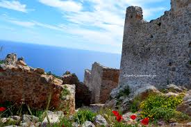
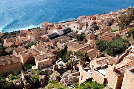
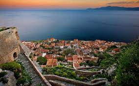
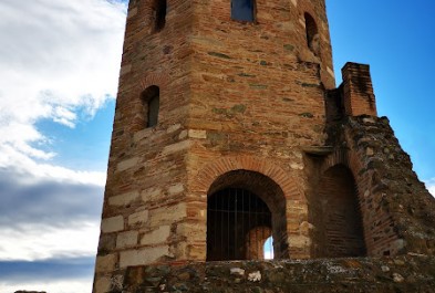
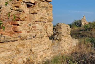
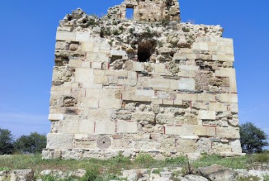
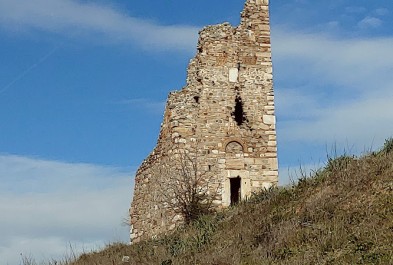
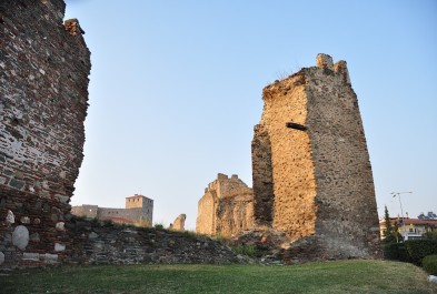
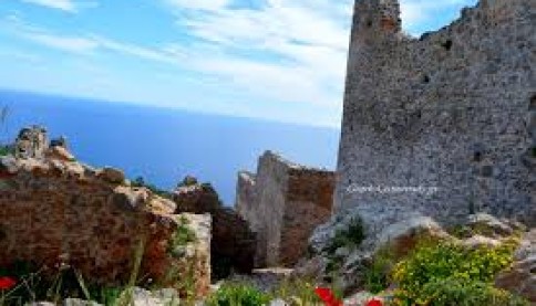
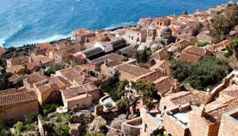
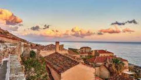
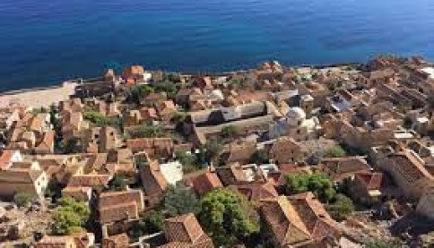
The town planning organization of the settlement follows the natural configuration of the terrain which allows the division into Acropolis, Upper town and Lower town. The Acropolis is located at the highest point of the rock. It is a trapezoidal Byzantine fortress with a tower at each corner. In the northeast, a circular tower may have served as an observation post or as a powder magazine.
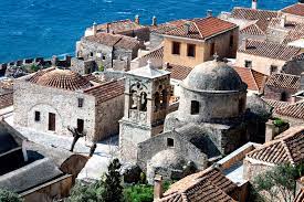
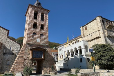
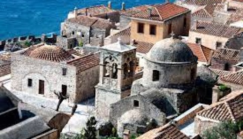
The Upper City develops to the east of the Acropolis, on the summit plateau, and is protected by a strong fortified enclosure, the "Goula", which is not continuous, since steep rocks replace it in several places. The only entrance opens in the middle of the southern leg of the wall, at the end of a winding road that ascends from the Lower City, the "Walks". This narrow gate leads through an arched corridor to a small plateau, to the north of which are the house of the Venetian governor of the city Sebastiano Renieri (1514), and a little further, to the north-east, the great church of Hagia Sophia, catholicon of a monastery originally dedicated to Panagia Odegetria, built around 1150.
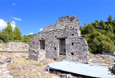
The Upper City was a large settlement, as evidenced by its considerable area (about 15 hectares) and the extensive building remains that can still be seen today. Those located on the inner side of the wall were garrison posts and military installations, while the rest were houses belonging to the local lords and the families of the respective lords. The only public building, a large building in the south-west section with tanks on two levels, seems to have been the headquarters of the commander. Inside Goula, there are preserved fountains, a bathhouse from the Ottoman period and three open cisterns for public use, absolutely necessary for the survival of residents and soldiers in cases of siege or drought.
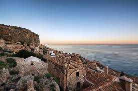
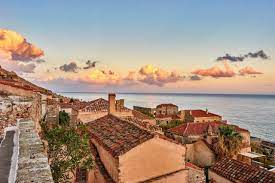
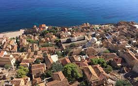
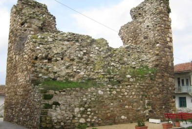
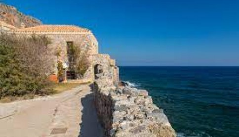
The Lower Town is protected by a P-shaped wall, the ends of which rest on the steep cliffs of the castle. The eastern and western walls gradually follow the slope of the land to the sea, while the southern wall follows the coastline. The height of the wall on the outer side is up to 10 m high, while on the inner side it is only 1.5-2 m, above the narrow road that passes at its base. There are four main points of entry and exit to the Lower Town: the central gate on the west wall, the exit to the sea on the south wall (the "Portello"), the east gate and the ascent to the castle in the north.
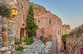
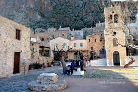
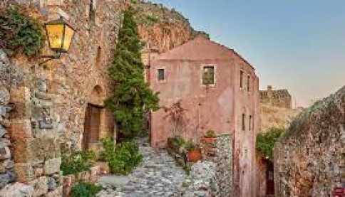
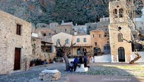
From the central gate of the western wall begins the main road, or otherwise "Agora" or "Foros", which runs parallel to the natural relief, passes through the central square and ends at the eastern gate. Commercial activities developed here, with shops and workshops on the ground floors of the houses, but also other buildings that met the needs of residents and travelers. Narrow vertical streets start from the main road and climb in steps to the castle, often under footpaths ("roadways"), or descend towards the sea. Another main road also starts from the west gate, extends to the south of the main road, passing through the two tapias, the "back", near the southwest corner and the bath of Sotiras, and the "beyond", in front of the church of Panagia Chrysafitissa , creating a large front in case of attack from the sea. A third road passes at the roots of the rock of Goula, starts from the extreme gate of the western wall and ends at the tapia of the eastern one, while approximately from the middle of it begins the ascent towards the Upper City.
In the central square are the metropolitan church of the Coming Christ, possibly founded on the site of an early Christian basilica, and the Bishopric, an Ottoman house of the 17th century, which became the property of the Metropolitan of Monemvasia Grigoriou and underwent conversions in later periods. To the west of the square is the mosque, which was built in the first period of the Turkish occupation and received extensions and conversions, while today it houses the Archaeological Collection. Two communal underground tanks extend below the central square and the "back" tapia.